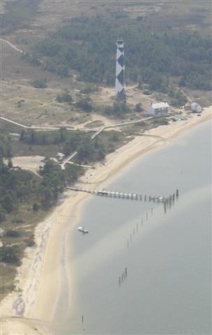
 The lighthouse dock is gone. |
|||
Geologists call these overwash fans, and they're evidence that the ocean overran the beach. This is about two miles from Drum Inlet. |
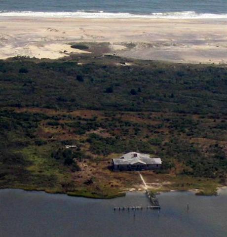
A long view of the Great Island Camp, looking east. The dunes are gone; the remaining cabins are exposed to even a unusually high tide. |
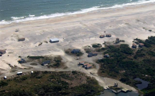 The caretaker's cabin is in the center, the dock on the bottom right |
|
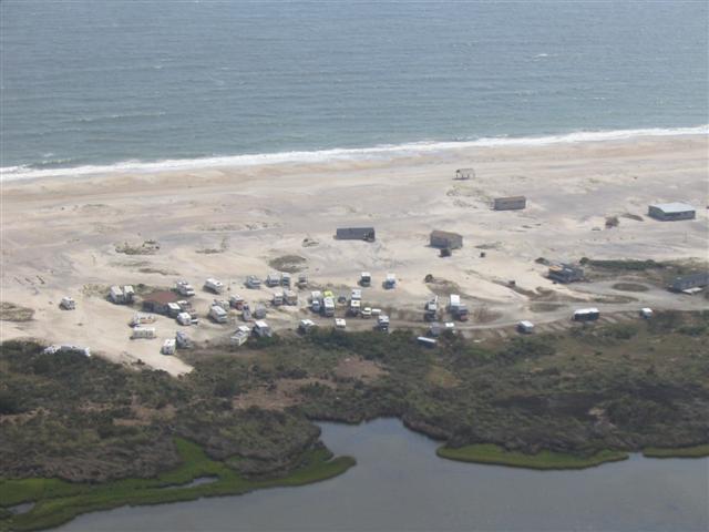
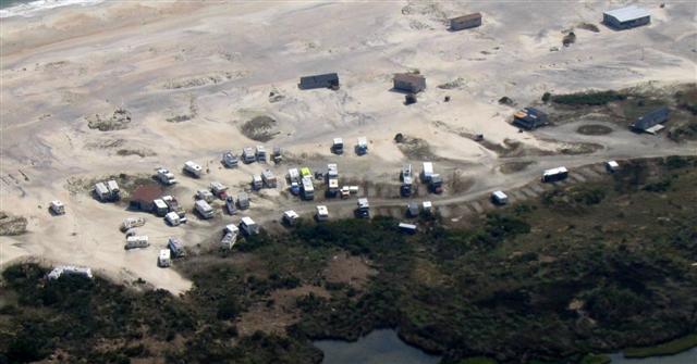 The camp parking lot. The camper on the bottom, far right, has overturned. Other vehicles have been jumbled together. |
 A longer view of the camp parking lot with a few remaining cabins scattered in the distance. |
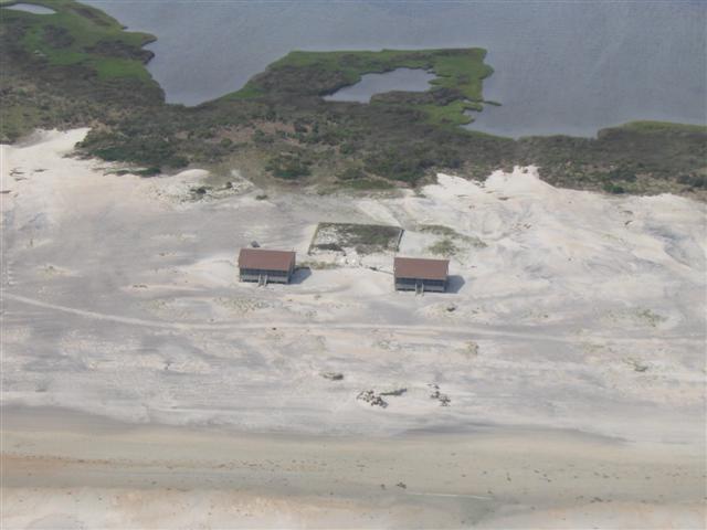
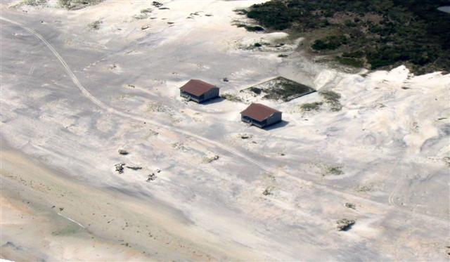 Cabins 10A and 10B sit naked against the ocean. |
A closer view of the camp parking lot. Notice the cabin. It wasn't there before the storm |
 A view of the south end of the camp. |
A longer view of the south end of the camp. |
Notice the gazebo near the dock. It's upside down. |
|
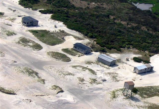 The north end of the camp. |
|
Yet another view of the parking lot. |
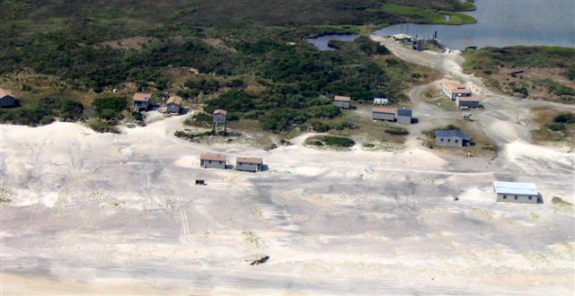
The center of the camp, looking west |
 The gun club. |
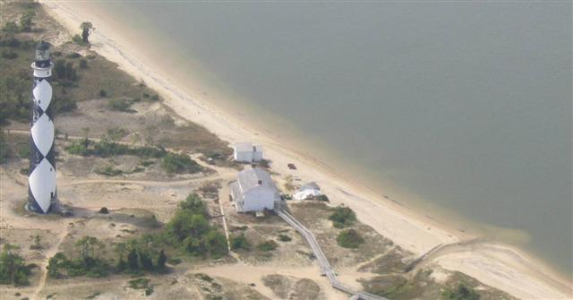 The lighthouse fared well. The small outbuilding did not. Notice, it collapsed |
 A more conventional view of the new north end. |
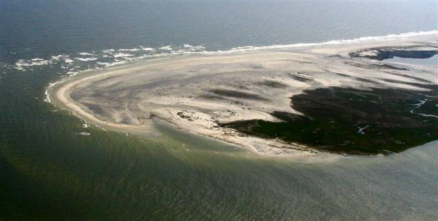
A massive overwash fan near Drum Inlet with the beginnings of a new inlet. Notice the cut at the top of the photo. There was water running through it when this picture was taken at low tide. This is directly across Core Sound from Sea Level. I suspect that this is Ground Zero, where the eye passed, pushing a wall of water over the island and across the sound. It inundated Sea Level. |
A funky view of north end. |
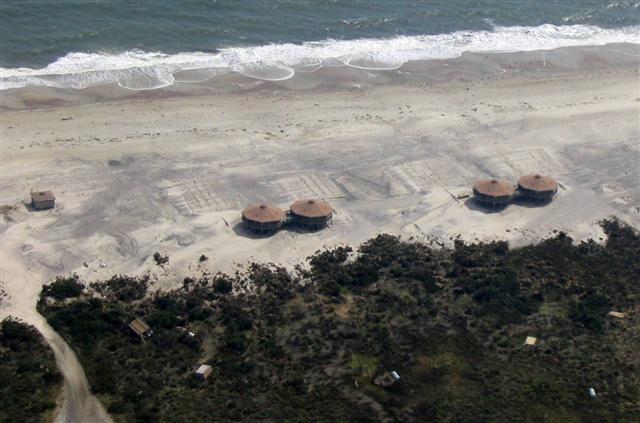 The octagon structures on Portsmouth Island. They seemed to have weathered the storm well. |
A longer view of the Morris camp. |
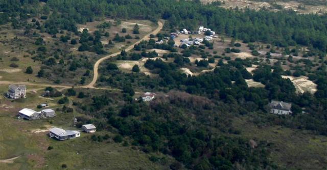
As did the other cabins on Portsmouth. There's no dune, but there hasn't been since Fran. |
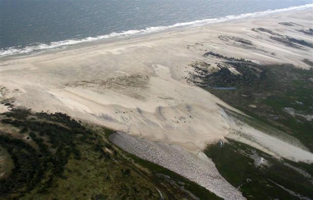 Another mighty overwash fan on Portsmouth. What you're looking at is an island in motion. Storms move sand from the beach and deposit it on the backside of the island. Enough storms over a long enough period of time will push the island backward. It's the way these island keep from drowning in place. They've been doing it for thousands of years, incrementally moving miles backward in the process. If you don't believe me, pick up an oyster shell on the beach the next time you visit Core Banks and ask yourself this question: What's the remains of a critter who spent it's entire life in the sound doing on the beach? That shell you have in your hand is probably a couple of thousand years old, when the sound was where you are standing. |
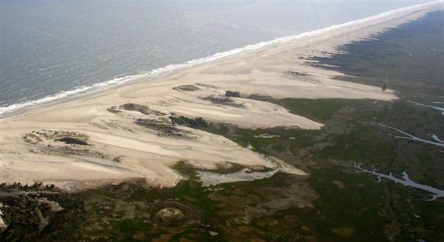 A series of impressive overwash fans just north of the Morris camp on Portsmouth |
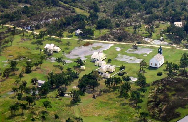 The old village at the end of Portsmouth was wet but still standing. |
More of the village |
All the beach is stripped of dunes and flat as a pancake. Here is a section just north of the lighthouse. Notice, no back road. Except for the area around the lighthouse, the road is gone. A few of the little Jeep signs stick out of the sand at odd angles to mark the road's former path. |
The parking lot near the lighthouse. All vehicles upright and seemed intact. No visible evidence of flooding. Breathe easy if you parked it here. |
 This is the area around the Bight. The Barden house is on the lower left and the south parking lot just east of it. This area fared well and was scheduled to be opened to visitors Monday. |
|